To see as much of the world as we can,
Using the smallest carbon footprint we can,
Spending the least amount of money we can,
Making as many friends we can.

Team Red Cruising

  • Southbound Day 8

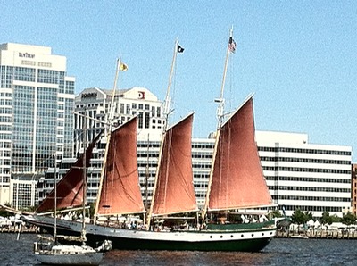
    It's a long day from Great Bridge to North River. Three lift bridges, lots of other boats.

    A35B33D8-E2F2-498B-8E39-500E15A7B976
    A35B33D8-E2F2-498B-8E39-500E15A7B976

    Here's the 08:00 bridge opening. From there, we have ½ hr to the Centerville Turnpike bridge. Then an hour to the North Landing bridge.

    Then it's about 4h 18m to Coinjock …


  • Southbound Day 7

    We went as far as Great Bridge, between lock and bridge. We're tied to the shore at 36° 43.284′N, 076°14.511′W.

    A7DEB542-8F60-45FE-A823-8CBEB0CE6C1F 1 105 c
    A7DEB542-8F60-45FE-A823-8CBEB0CE6C1F 1 105 c ""

    We had some drama, but we sorted it out well enough.

    Looking back at the plan, we were supposed to blow …


  • Southbound Day 5

    1B43D141-E689-4B77-966D-3AEFEE82A1FB 1 105 c
    1B43D141-E689-4B77-966D-3AEFEE82A1FB 1 105 c

    Dolphins! And painful weather. But. First. Dolphins!

    Running around the deck to look at them made it difficult for us to get the anchor up.

    The weather did not cooperate, either.

    CA broke out the camera and banged away at trying to capture some images. It's …


  • Southbound Day 3

    We've never been to Mobjack Bay. It's time to correct that. There are four rivers that flow into the bay, and each has a number of well-regarded anchorages. I rolled the four-sided die and picked the Severn River.

    The engine went on a 09:00, the anchor was up at …


  • Southbound Day 2

    Sometimes things work out.

    Today's weather is NW winds 10-15 kt. We're headed south. This would be great sailing.

    Except. We've got to cover 47.5 nautical miles. Unless we can sail at a steady 6 kt, we're looking at arriving after dark. Not a pleasant prospect. While the Piankatank …


  • Southbound Day 1 - October 13

    Nothing ever works out perfectly. For the most part, we have to settle for good enough. We finally left Herrington Harbour. We topped off the water. Picked up the fenders and docklines, and chugged out into the Bay on the morning of October 13th.

    Winds were nearly flat (less than …


  • Mobility

    The point of a sailboat is a way to be mobile.

    That means we don't own much.

    Here's what was in our apartment the morning we left Virginia:

    2065AF0B-E8D2-4E72-A36C-9AE89DF14A06 1 105 c
    2065AF0B-E8D2-4E72-A36C-9AE89DF14A06 1 105 c

    An Ikea Poäng chair, a cart, a computer, and some luggage.

    The chair had to be given away …


  • Finding a Single Source of Truth

    We have a primary chart plotter on Red Ranger. And we have backups. A lot of backups. A second chart plotter, an iPad, a MacBook pro. I even have iNavX on my phone, so it can work under limited circumstances. (I don't have all of the US East Coast charts …


  • Getting off the dock (or "Shakedown")

    Red Ranger last moved in once in August 2020 and again in October 2020. Before that she last moved in October 2018. She hasn't been out of the slip in the last 8 months.

    We decided to go back to Cambridge, MD, for Memorial day.

    On the way… the Pride …


  • Richmond-Bound

    "But wait," you say, "Richmond is inland. And has a class IV rapids. Red Ranger can't get that far up the James River."

    Fan 2
    Fan 2

    Yes. That would be true.

    This chapter of Red Ranger's cruise is drawing to a close.

    Our tenure as full-time liveaboard cruisers is ending. We …


  • Northbound to Deltaville

    Started Hospital Point 36°50.61′N 076°17.93′W

    Docked Deltaville Marina C Dock 37°32.95′N 076°19.78′W

    Log about 42 nm. Time 9 hrs. Engine 6 hrs.


    We had a sail that was simply amazing. I credit two things.

    IMG_2674
    IMG_2674 ""

    We started at …


  • Closing the Loop in Norfolk

    Started: The free dock near the Great Bridge bridge, 36°43.25′N 076°14.26′W, ICW mile 12.

    Anchored: Hospital Point, Norfolk, 36º50.61'N 076º17.93'W, ICW mile 0.

    Log: 12 mi. Time: 5 hr. Engine: 5 hr.


    Norfolk. Our home port. And for good reason.

    IMG_2538
    IMG_2538 ""
    IMG_0864
    IMG_0864 …

  • Great Bridge, VA

    Started: Coinjock Marina, 36°20.87′N 075°56.96′W, ICW mile 50.

    Docked: The free dock near the Great Bridge bridge, 36°43.25′N 076°14.26′W, ICW mile 12.

    Log: 38 mi. Time: 6 hr. Engine: 6 hr.


    Except for some drama, today featured a …


  • Return to Coinjock, NC

    Started: Alligator River, 35°40.49′N 076°03.50′W, ICW mile 99.

    Docked: Coinjock Marina, 36°20.87′N 075°56.96′W, ICW mile 50.

    Log: 50 mi. Time: 8½ hr. Engine: 8½ hr.


    We started at mile 1095 on the Atlantic ICW on 22 April. We're …


  • Welcome To The Ditch

    Started: Bonner Bay, 35°09.61′N 076°35.65′W, ICW mile 159.

    Anchored: Alligator River, 35°40.49′N 076°03.50′W, ICW mile 99.

    Log: 50 mi. Time: 9¾ hr. Engine: 9¾ hr.


    The day started with an odd squawking or shrieking. Likely a bird in …


  • Sporty Day on the Neuse River

    Started: Beaufort Town Dock, 30°40.24′N 081°28.17′W, ICW mile 204

    Anchored: Bonner Bay, 35°09.61′N 076°35.65′W, ICW mile 159

    Log: 45 mi. Time: 8 hr. Engine: 4 hr.


    The rain was real "wrath of God" rain. Not figuratively, but literally …


  • Epic Northbound Voyage, Part II

    Started: Fernandina Harbor Marina Moorings, 30°40.24′N 081°28.17′W

    Anchored: Fort Macon, near Beaufort, NC, 34°42.10′N 076°41.14′W

    Log: 358 nm. Time: 60 hr. Engine: 60 hr. Fuel 36.7 Gal.


    Part I — except for the fuel gauge — went flawlessly. Since …


  • Epic Northbound Voyage, Part I

    Started: Coconut Grove near Dinner Key Marina, 25°42.92′N 080°13.63′W

    Moored: Fernandina Harbor Marina Moorings, 30°40.24′N 081°28.17′W

    Log: 304 nm. Time: 60 hr. Engine: 60 hr. Fuel: 56 gal.


    Even when stuff started breaking, this was still an epic …


  • Back to the Ball and The Price of Failure

    Started: Star Island 25°46.56′N 080°09.25′W

    Mooring: Coconut Grove near Dinner Key Marina, 25°42.92′N 080°13.63′W

    Log: 8.5 nm. Time: 2 hr. Engine: 2 hr.


    Great party on Perfect Partner. Great tour of Lincoln Road Mall on Miami Beach …


« Page 3 / 7 »