To see as much of the world as we can,
Using the smallest carbon footprint we can,
Spending the least amount of money we can,
Making as many friends we can.

Team Red Cruising


  • Starting 2023

    Cthulhu Waiting To Consume Mankind
    Cthulhu Waiting To Consume Mankind

    Where are we at the start of the year?

    Waiting for some repairs to Red Ranger.

    Traveling through New Mexico. This is in Carlsbad Caverns.

    Here's how I figure out what week we're in.

    >>> from datetime import date
    >>> start = date(2021, 10, 20)
    >>> today = date …


  • Cross-Country Tour, Week 5

    We're not on the boat. Nor are we in our hurricane-season hide-away near Asheville, NC.

    On October 20th, we loaded the truck and started west. Some places are bivouac locations, other places are proper destinations. Catch up on mail. Do some birding.

    • Week 1
      • Oct 20 - Mount Juliet, TN (near …

  • Cross-Country Tour

    It's been about 54 days since Hurrican Ian. We have a mechanic, a canvas company, and a carpenter working on things. While Red Ranger is getting fixed, what have we been doing?

    We've been seeing our kids (and grandkid) on the west coast.

    And -- of course -- seeing the west coast …


  • Ph. VI, day 14, Safe Cove

    Tied To Dock. 26°52.3529′N 082°14.0032′W.

    This was a "Sphincter-Clenching" day.

    We started by deflating Scout and removing the head sails. Easy things to do at anchor when there's not a breath of air moving.

    Headsails Struck Below
    Headsails Struck Below

    Anchor Drama

    The Rocna anchor would not …


  • Ph. VI, day 13, Myakka River

    Anchored. 26°57.0662′N 082°11.2751′W.

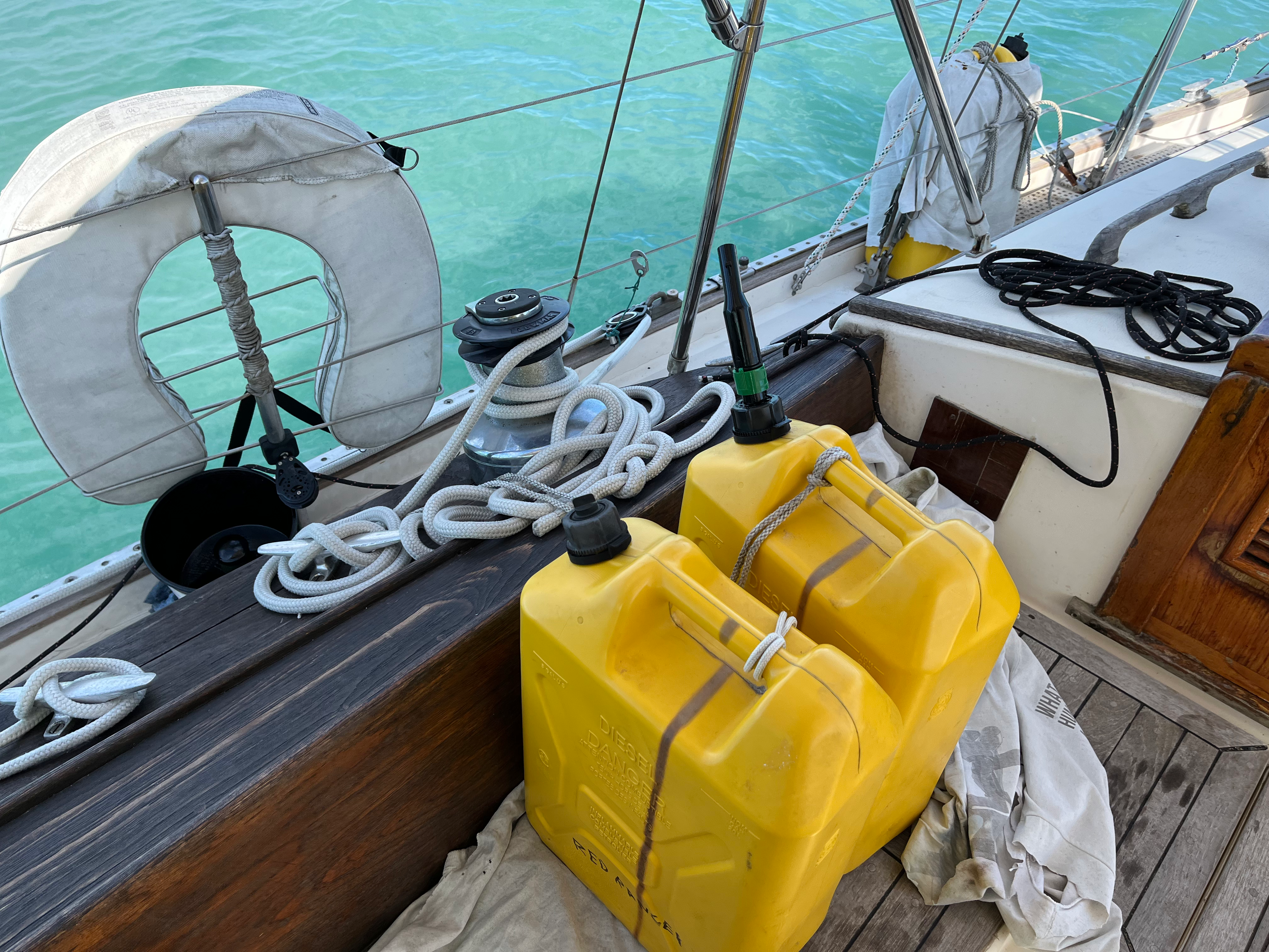
    We're cruisers. I think all cruisers carry jerry jugs of spare fuel on deck.

    Fuel Transfer
    Fuel Transfer

    Since this is the end of this cruising season, we poured the fuel from jerry jugs into the tank.

    This can be messy and involve …


  • Ph. VI, day 12, Boca Grande

    Anchored. 26°43.6071′N 082°15.2692′W.

    The early morning part of the trip was delightful. We had 10-15 knot winds from a direction that was ideal.

    For a while.

    Boca Grande Anchorage
    Boca Grande Anchorage

    The Macerator Pump

    Our boat has a 40-gallon (150L) holding tank. Plus a Nature's Head …


  • Ph. VI, day 1-2, Bound For Marco Island

    When we depart, we always say we're "bound for" a destination, like Marco Island. We're not necessarily going to actually get there. It's the ocean: things will change.

    The Dry Tortugas
    The Dry Tortugas

    The Plan

    The plan is an 18-hour overnight passage. Leave at noon, arrive at dawn. Due to DST, dawn …


  • Ph. V, day 2, Dry Tortugas

    Anchored at 24°37.5312′N, 82°52.3086′W.

    Fort Jefferson -- centerpiece of the Dry Tortugas.

    Fort Jefferson
    Red Ranger outside Fort Jefferson

    From Boo Boo Key, it's a solid 6 hours to the Dry Tortugas.

    We had 1-3' seas, which is manageable, but unpleasant. It's at the edge of being …


  • Ph. V, day 1, Boo Boo Key

    Anchored at 24°34.1905′N, 82°10.1428′W.

    This is the start of Phase V -- The Dry Tortugas.

    Boo Boo Key
    Boo Boo Key

    The first leg of the trip to the Dry Tortugas from Key West is to Boo Boo Key. This is a patch of mangroves they call "The …


  • Ph. IV, day 25, The Conch Republic

    Moved! We're now docked in Slip A-15 at the Key West Bight Marina. Our location is 24°33.775′N 81°48.0516′W.

    KWBM
    KWBM

    We're at a dock. This means several things.

    • We moved from the mooring field.

    • Top off the water. We're down about 50 gallons in the …


  • Ph. IV, day 15, The Conch Republic

    We've moored in the Garrison Bight Mooring Field. Our location is 24°34.704′N 081°47.151′W; putting us on one of the furthest balls out in the mooring field, a full mile from shore.

    Key West Sunset
    Key West Sunset

    Big Lesson Up Front: Taking your own boat to Key …


  • Ph. IV, day 14, Little Torch Key

    We've anchored near Pye Key and Torch Key. While we dropped the anchor at 24°39.803′N 081°25.583′W, we didn't stay there.

    I did not read the coastal pilot carefully. The "controlling depths" for the channels near here are 3½′ and 4′. This is a place …


  • Ph. IV, day 6, Boot Key/Vaca Key

    Our fourth Island-hopping "day sailing". (Ugh. Again. Not actually sailing, the wind was almost on the nose, so it was a 5-hour motor.)

    Boot Key Harbor
    Boot Key Harbor

    We're moored on ball K-9 (at 24°42.250′N 081°05.550′W) in Boot Key Harbor. It's between Boot Key and Vaca …


  • Ph. IV, day 3, Lower Matecumbe Key

    Our third day of "day sailing" to go island hopping. (Again, not actually sailing, the wind was on the nose, so it was a 5-hour motor.)

    Lower Matecumbe Key
    Posh homes on Lower Matecumbe Key

    We're anchored at 24°51.762′N 080°44.516′W, not far from Lower Matecumbe Key. There's …


Page 1 / 6 »