

Dolphins! And painful weather. But. First. Dolphins!
Running around the deck to look at them made it difficult for us to get the anchor up.
The weather did not cooperate, either.
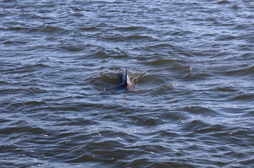
CA broke out the camera and banged away at trying to capture some images. It's difficult because — well — they're evasive. You catch glimpses all around the compass. They spend a lot of time underwater.

I think they look up at us, standing on our boats, and decide to surface somewhere we're not facing. It's a big joke to them, watching us lumber around waving and pointing.
I'm sure they know we're looking at them.
The same way we know they're crashing a buffet line looking for bait fish up in the river.
After the dolphin sighting, the rest of the day was rough.
The weather was mostly awful. Wind was gusting to over 20. This is never fun weather on the Chesapeake. Waves were three to four feet. We're happy it didn't rain; that was nice.
The wind was from the north, which is fair for pushing us down the bay. It was supposed to die out in the afternoon. But.
It seemed prudent to set out, knowing the wind would be helpful. We've sailed the Bay for a few years, we knew it would be rough. We were hoping the dying out later in the afternoon would help.
The shift in the winds never happened. It was sporty all day.
We had a brief moment where we thought about putting up the mizzen and stays'l, but the rolling and bucking were too intimidating. We didn't have jacklines rigged, and CA didn't like the idea of me scrambling around without jacklines and a tether to keep me onboard.
Even in the Elizabeth river, the wind from the N was raising whitecaps.
Anchor down near Hospital Point at 36° 50.6140′N, 076° 18.0220′W. We've anchored here many times before.
Very late in the day, the wind dropped. The most importing thing is that we've finished part I of the southbound trip. We can relax and take a week or two to get the Beaufort.

Travel
| Attribute | Value |
|---|---|
| Depart | Bryant Bay 37°19.5000′N 076°26.6830′W |
| Arrive | Norfolk 36°50.6140′N, 076°18.0220′W |
| Distance | 39 nm |
| Time | 6h 50m |
| Engine | 6h 50m |