To see as much of the world as we can,
Using the smallest carbon footprint we can,
Spending the least amount of money we can,
Making as many friends we can.

Team Red Cruising

  • Another Family Visit

    FullSizeRender
    FullSizeRender

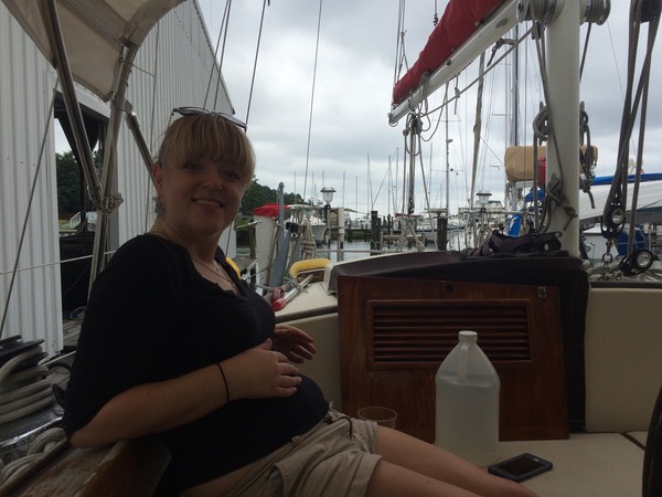
    That's my sister, Elizabeth. One of many sisters. This was her first chance to actually go sailing. We showed her many — but not all -- of the boaty things on Red Ranger: we hoisted most of the sails, we had a pleasant drift, we dropped the anchor, had some lunch …


  • Taking Philip to Oxford

    How do you introduce someone to the sea?

    CA's Venerable Great Aunt Diane (vGAD) came to visit for a long weekend. She's been on Red Ranger many times. She brought more of CA's family: Maddy and Philip. Maddy has been to Red Ranger before, but Philip's never been here before …


  • Herrington Harbor North [Update]

    What's important is that nothing seriously failed. Stuff broke. We worked around it. Here's the overview. Details follow.

    Friday

    IMG_1583.jpg
    IMG_1583.jpg

    1600 - Move to fuel dock. Take on 54 gallons.

    1710 - Anchored in Piakatank River at 37°32.132N 076°19.318W

    This is a move of about a mile …


  • Final Preparations

    Years and years ago — when we first started taking sailing lessons — one of the old salts who helped us out had some simple daily procedures.

    1. Check the engine oil.

    2. Check the weather.

    3. Check the winds and tides.

    IMG_2936.jpg
    IMG_2936.jpg

    He had a piece of paper where we wrote down the …


  • The Move North

    The problem with being weekenders is access. When we lived in Norfolk, Red Ranger was in Deltaville, just an hour and change away. It was a relaxing drive after work every week. When we moved to Richmond, Red Ranger was back in Deltaville, about two hours away.

    Now that we're …


  • Dymer Creek: 37°40.281N 076°21.201W

    Labor Day weekend. The weather on the Chesapeake is (potentially) delightful.

    We had — well — a bit of weather. Technically, it was more sea state than we like. The wind was tolerable. The waves? Not so much.

    For much of the summer, we've been working (steadily) on refinishing the brightwork. Once …


  • Yopp's Cove: 37°39.070N 076°26.073W

    As long as nothing breaks, today might work out well. After being beaten down by weather yesterday, we find our plans are quite humble.

    The forecast was for 13g15 (13 knots gusting to 15). When the tide turns, the seas will drop from over 3' to just 3'. This can …


  • The Kids Came To Visit

    "The Kids" (Xan and Han) live way out west. LA and Las Vegas. Once in a while they can structure their vacation to come east and visit mom and dad.

    IMG_1393.jpg
    IMG_1393.jpg

    It was a cloudy day with wind out of the E at 17g22. A sporty day in the …


  • Guests

    IMG_1373.jpg
    IMG_1373.jpg

    Went sailing with a bunch of guests from work. Did I take pictures? No.

    That's sort of awkward, isn't it?

    I did take this picture.

    It's a cleat that attaches to a shroud. We use these for our various flag halyards.

    It broke. So I took a picture …


  • Fireworks and the return

    Once we finished fixing the various things that needed fixing, we could do what we planned to do in Norfolk. Nothing. The trip back was eventful and a bit more delightful than the trip down.

    The fix list from the trip down was reviewed in "Running down to Norfolk." Here's …


  • Running down to Norfolk

    The trip down wasn't a "delight." It was eventful, but we pulled if off without a major problem. Except for the panhandlers.

    We made the dock by 19:00 more-or-less. The wind was almost non-existent. We were out of the creek on a rising tide during the last hour of …


  • Planning for July 4th in Norfolk

    We'd like to leave July 2, Thursday night, and do an overnighter down the bay to Hospital Point. It's 36 miles. Rate×time=distance, right? How hard to can it be?

    The basis for all of the planning is to work out the departure time. We don't want to arrive …


  • Return from Cape Charles

    Tall Ships. Fellow Sailors. Beer. Food.

    There's nothing quite so good.

    Defeating the Arch-Enemy. Even better.

    Video: Red Ranger in the Chesapeake.

    It's about 25 miles from Deltaville to Cape Charles. With a fair wind, it can be done in 4-5 hours.

    IMG_1282.jpg
    IMG_1282.jpg

    With a contrary wind, it can …


  • Cape Charles

    We took a weekend trip from Deltaville to Cape Charles. Our first weekend jaunt in two years. There was some drama, but none that caused any lasting problems.

    Cape Charles is cute, and historic, and a comfy sail from either Deltaville or the Norfolk area. We had never visited the …


  • DelMarVa Circumnavigation—Retrospective

    Do it again? Absolutely. It is a great trip.

    Changes?

    • No schedule for a rendezvous with the family.

    • No attempt to meet folks at an anchorage (like Lewes). Only meet folks at dockside.

    • More time to wait for fair winds and tides.

    Summary

    11 days on the boat.

    72 hours …


  • DelMarVa Circumnavigation—Day 2

    New for August 4th:

    • Watching closely for container ships. In the Southern Bay, the shipping channel is close to the Eastern Shore. We barely see the ships. Up here, however, they're right in the middle of the bay! An AIS tracking app on the iPhone (like Marine Traffic) helps. Proper …


  • DelMarVa Circumnavigation—Day 1

    Here's the key conversation.

    CA: "Tell me when we get past Smith Point."

    Me: "Why?"

    CA: "From the point, the entire rest of the trip is new territory."

    Things we did on August 3rd:


  • Float Plan – August 3-7

    We're bound for Lewes Delaware, just inside Cape Henlopen, via the C&D canal.

    The float plan assumes that (1) wind and weather are with us and (2) we have no mechanical problems along the way. It's about 200nm, which is about 40 hrs of travel time. Life is full …


« Page 2 / 3 »