

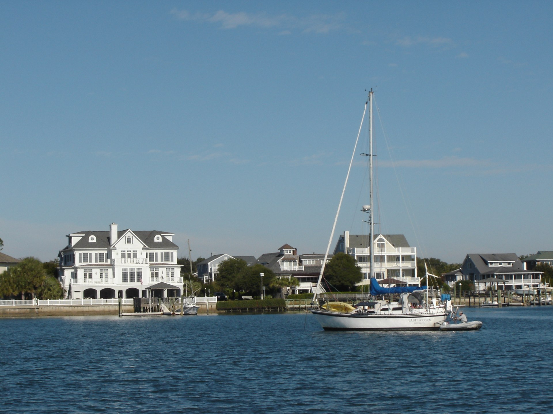
This week we're starting south from Beaufort, North Carolina.
The Commodore Says: "I think we're ready to jump outside."
The Ditch has been very, very good to us. We sheltered from Hurricane Sandy. We got our sea legs. We worked out some of the kinks in the boat and our boat-handling skills.
Three important points about Hurricane Sandy.
Patience. Hard Work. A Sense of Perspective.
-
Patience. It will blow over.
-
Hard Work. We had to prepare and deploy heavy anchors, chain, snubbers and a marker more than once. We had to batten down all the hatches, remove the dorade vents, tighten up everything that might flap or get loose. We had to find a secure creek. Also we had done our homework in ASA sailing classes to understand weather and how Hurricane winds will "back" counter-clockwise if a storm passes north of us.
-
Perspective. The boat is designed to handle more than we're comfortable with. The boat is built to handle towering seas and hellacious winds. The FRP (fibre reinforced plastic, "fiberglass") boat hulls are well understood and the Whitby Boat Works has a solid track record of building over 200 boats that have stood up to the seas. We may be scared, but the boat is solid. Also. The storm was way north of us.
5th. Monday.
Last night we were planning to head out around noon, find the big "RW" sea buoy in the afternoon and sail down to Masonboro Inlet overnight. Weather seems fair in Zones 158 and 250.
Today, however, it's cold. Nasty 3°C (40°F) cold. Tonight would be brutal standing watch on deck in the cold. Hypothermia, impaired judgement, mistakes were made kind of cold. No thank you. Not doing it.
Down the ditch we go.
The dockhands at Beaufort showed as a cool trick for pivoting Red Ranger out of her slip in spite of a fairly robust river current.
We drove down the Bogue Inlet, past Swansboro, NC, through Camp Lejeune, ran hard aground at the Brown Inlet marks, barely made the Onslow Beach Bridge opening at 1530. In all, an exciting day.
Then.

Our AIS warns us that we're close to Joie de Vivre. Another Whitby! In Mile Hammock Bay, just off Camp Lejeune.
It's Party Time! Raft Up!
And. Listen to the Osprey aircraft, helicopters, ordnance, and arms fire. Thanks goodness the marines sleep at night. It was transported back to my childhood home—a few miles from the NYS National Guard rifle range—going to sleep by the sound of intermittent gunfire. Sort of like living near a war zone. The big difference is that the USMC has heavy ordnance that the NYS National Guard didn't have. I don't think I ever head canon fire before (if that's what it was.)
Started at 34°42.94′N 076°39.86′W

Rafted up with Joie de Vivre with at 34°33.03′N 077°19.54′W
Time: 6 hrs. Distance 34 nm rhumb, ICW Mile Marker 244.
Dinner with Joie de Vivre was quinoa with butternut squash and peppers and some cornbread.
Travel
| Attribute | Value |
|---|---|
| Depart | Started at 34°42.94′N 076°39.86′W |
| Arrive | Rafted at 34°33.03′N 077°19.54′W |
| Time | 6 hrs. |
| Distance | 34 nm |
| ICW Marker | 244 |
6th. Tuesday
Breakfast with Joie de Vivre; then left from the raft-up at 34°33.03′N 077°19.54′W
Motored to 34°12.28′N 077°48.03′W
This was one awfully cold day. Rainy. Cold. And more cold. Barely over 10°C (50°F). A bone-chilly rainy cold.

The trip down through Stump Sound and Topsail Sound was (potentially) very pretty. Except it was grey and rainy and we couldn't squat outside the ICW ditch.
We had three lift-bridges on this leg. There's an art to timing these things and we did it totally wrong.
The first bridge (Mile 260) is the Surf City Bridge. This only opens on the hour. So, you leave Mile Hammock Bay at 0830 and pace your 16 mile motor to arrive at 1100 (6.4 mph, 5.5 kn).
The next bridge (Mile 278) is the Figure Eight Island Bridge. This opens on the hour as well as the half hour. If you're clever, you pace your next 18 miles to to take three hours (6 mph, 5.2kn), and arrive at the top of the hour, say 1400. We did this wrong and managed to arrive at 1330, which was simply a waste of fuel.
The third bridge (Mile 283) is the Wrightsville Beach Bridge. This opens on the hour. Since it's only five miles further, you can trivially pace yourself to arrive when it opens at the top of the hour (5 mph, 4.3kn).
Time: 8:30 hrs. Distance 31 nm rhumb, ICW Mile Marker 283.
It took three tries to get anchored behind Wrightsville beach. The first spot didn't hold. The second was a bad location: we put the anchor down, looked around, saw where the other boats where, and pulled it back up. Finally we got the anchor down in fairly deep water (over 15'); it has held for an hour, making us confident enough to shut down Mr. Lehman and make some dinner.
We broke our glass french press. Rather than push on down the ICW, we'll go ashore here and do some shopping and walking about.
Travel
| Attribute | Value |
|---|---|
| Depart | Rafted at 34°33.03′N 077°19.54′W |
| Arrive | Motored to 34°12.28′N 077°48.03′W |
| Time | 8:30 hrs. |
| Distance | 31 nm |
| ICW Marker | 283 |
7th. Wednesday
Anchored at 34°12.28′N 077°48.03′W
Waiting out the cold. Drying out, too. Yesterday drained us. Our foulies are carefully stacked around the deck to dry in the cold wind and feeble sunlight. It's a good day to huddle in the cabin in our fuzzy slippers, sipping hot tea.
Over the next four days, temperatures will soar from today's predicted high of 13°C (55°F) to Sunday's high of 22°C (72°F). Sailing in the 20's is much more fun than sailing in the teens.
So our plan is to sit here.
Then, on Friday, we might head down the Cape Fear River to Bald Head Island Marina and take a slip there. Then, on Saturday and Sunday, we can sail down to Charleston. This is about 110 nautical miles, something that would take us about 20 hours. We can easily drag it out to 24 and arrive the next morning, working our way up the Ashley River to an anchorage.
We took the dinghy to the municipal dock just S of the causeway. We had a delightful lunch at the South Beach Grill.
We walked the 2 miles to West Marine (and back) to look for a replacement coffee maker. The class carafe in our french press finally broke; we suspected it would. We didn't find anything perfectly suitable, so we're going to try a percolator.
CA drove the dinghy for the first time. A big milestone. The new dinghy and rebuilt motor are much more stable and reliable; there's nothing to fiddle with to keep the engine running and no hard-to-explain tricks for steering the old dinghy which was entirely flat on the bottom.
Dinner was tortellini with a red sauce, tuna, kale and cabbage.
It was a cold, cold night. Down to 1°C. We didn't have the residual heat off Mr. Lehman like he had last night.
Travel
| Attribute | Value |
|---|---|
| Arrive | Anchored at 34°12.28′N 077°48.03′W |
8th. Thursday
Anchored at 34°12.28′N 077°48.03′W
Today, we're puttering around, trying to finalize stowage for all the stuff we crammed into the V-berth 8 weeks ago.
Has it really been two months?
So far, we've been doing nothing and we're already two months behind.
We did some Geocaching today; more walkies around Wrightsville Beach.
I started to rewire the alternator to make it powered by the key, instead of the engine start alarm breaker on the circuit breaker panel. The engine start alarm breaker has the advantage of simplicity. The key has the advantage of being only on when we're running the engine.
What's the issue?
This: the alternator's field circuit draws an amazing 3 amps. When the engine start alarm breaker is on—because we might need to start the engine—this is a large overhead. If I relocate the alternator's power source to the starting key, then alternator's field circuit is only energized when the engine is actually running.
The problem is that the key also activates the alarm buzzer. If I just want to change programming on the regulator, I have to endure the damn low-oil-pressure buzzer. To work around the buzzer, I can just leave both wires available and switch from noisy key wiring (for normal use) to quiet circuit breaker wiring if I never need to change the alternator's settings.
Weather for the trip to Charleston covers four zones: AMZ252, AMZ254, AMZ256 and AMZ350.
Our revised plan is this:
On Friday, we can head down the Cape Fear River right out into the Atlantic bound for Charleston. No stopover on Bald Head Island. This is a total of about 135 nautical miles, something that would take us about 27 hours. If we leave 8-ish, we might arrive 11-ish and work our way up the Ashley River to an anchorage.
The Friday-Saturday weather won't be as great as the Saturday-Sunday weather. But. We're ready to move on.
Dinner was sautéed tofu and broccoli over penne pasta.
Travel
| Attribute | Value |
|---|---|
| Arrive | Anchored at 34°12.28′N 077°48.03′W |
9th. Friday
While Wrightsboro Beach is nice, it's still cold. We need to head south.
We went down the ICW from Wrightsville to the Ceap Fear River. From there, out into the Atlantic. We handily bypass Frying Pan Shoals this way, saving a few miles.
We've only done one overnight passage before this on Red Ranger; that was days 10 and 11 of our DelMarVa circumnavigation. I've done a few on my one and only delivery experience: 2008 Ft. Myer to Hilton Head.
So far, here's our "standard" procedure (where standard means a sample size of 2). We try to do 3-on-3-off from 9PM to 9AM. We also try to log our position, heading, and status every hour. Unless we're too enraptured by the Leonid meteor shower. Then, perhaps, we just stare at the dark, quiet ocean rushing by.
- CA takes an afternoon nap.

A good practice in general, but more important when there's a long night ahead.
- Eat a hearty dinner at around 6-ish. CA was sea-sick because the conditions were very rolly. There was zero wind, so we were simply motoring through a slow 2-foot swell that rolled Red Ranger.

Also, CA had dumped the Natures's Head once we were outside the 3-mile limit: all the cleaning and repacking with peat moss was a lot of confined work below decks—a guarantee of a queasy stomach. Dinner was a cup of soup and a cheese sandwich. Not quite the ideal level of heartiness. But it kept me happy until midnight.
-
Put something warm on the stove. In this case, we've been using a box of Rice-A-Roni. It's very simple to prepare, filling, and can sit in the pressure cooker through the night to provide a warmish snack.
-
CA does 2100 to 0000 watch. Steve goes to sleep at 2100.
-
Steve does 0000 to 0300 watch. He eats about half the Rice-a-Roni.
-
CA does 0300 to 0600. She eats the rest of the Rice-a-Roni. Then she sneaks below to reset Steve's alarm so that she can do an extra hour to enjoy dawn watching the sun rise over the ocean. Steve, however, sneaks out of bed to use the head and catches her in the act, banishing her below.
-
Steve does 0600 to 0900. He gets to enjoy sunrise. When CA gets up at 0900, Steve gets second breakfast.
Because of the Charleston tides, we paced our passage to arrive 10-ish. A leisurely 5 kn passage covered the distance in about the right amount of time. There was no wind, so we simply motored at 1450 RPM.
Started 34°12.28′N 077°48.03′W
At midnight 33°16.610′N 078°58.762′W
TIme: 16 hrs. Distance: 81 nm rhumb.
Travel
| Attribute | Value |
|---|---|
| Depart | Started 34°12.28′N 077°48.03′W |
| Waypoint | At midnight 33°16.610′N 078°58.762′W |
| TIme | 16 hrs. |
| Distance | 81 nm |
10th. Saturday
At dawn, a steady (but light) NW breeze started; we motor sailed under staysail at 1300 RPM until we reached the line of buoys that marks the entrance to Charleston.

From about 10:30 to about 13:30 we had a pleasant flood tide up the Ashley and Cooper rivers to the Cooper River Marina. We're tied to the "day" dock because there are so many southbound transients.
The Charleston Municipal Marina (right downtown) was full, so we're way out here, about 8 miles from downtown. The Cooper River Marina has a shuttle; there are taxis; it's 2.5 miles to the nearest bus stop; we have our folding bikes.
There's no diesel fuel here, so we'll have to go to another marina to get fuel. We can probably take on about 40 gallons.
At midnight 33°16.610′N 078°58.762′W
Docked at 32°49.93′N 079°56.03′W
Time: 13 hrs. Distance: 55 nm rhumb. ICW Mile Marker 467.
Dinner was tortellini with a red sauce, tuna, kale and cabbage.
Travel
| Attribute | Value |
|---|---|
| Waypoint | At midnight 33°16.610′N 078°58.762′W |
| Arrive | Docked at 32°49.93′N 079°56.03′W |
| Time | 13 hrs. |
| Distance | 55 nm |
11th. Sunday
Docked at 32°49.93′N 079°56.03′W
Rest.
Laundry.
Rig hangers for the dock lines so they have a secure home when we're not docked.
Wash the salt off the decks and hatches.

Clean and lube the last two deck winches (finally). This has been on the to-do list for three years. The big Lewmar #48 winches are both large and rather complex. A one-speed winch goes one way around and has a simple pair of pawls. A two-speed winch has two sets of gears (with different ratios) and two sets of pawls. The big ones have only two sets of gears but they have three sets of pawls to handle the insane loads you'd put on a winch that big.
Rig some kind of handles for the Nature's Head so we can dump it at sea without worrying about dropping it in the ocean.
Dinner was tofu with kale and shredded carrot on a bed of white rice.
Travel
| Attribute | Value |
|---|---|
| Arrive | Docked at 32°49.93′N 079°56.03′W |
This Week
Engine Hours: 44. Diesel Gallons: 40. ICW Miles: 262.
Books: Agent Garbo; Deceiving Hitler; Operation Mincemneat; She's Come Undone; River Keepers.
Read Aloud: The Game of Thrones: Clash of Kings.
Travel
| Attribute | Value |
|---|---|
| Engine | 44. h |
| Fuel | 40. gal |
| Distance | 262. nm |
