

The goal was Annapolis in early April. Clearly, that objective is blown. Sky High.
Letting the big picture sort itself out, we've got a bunch of little steps to take.
-
Get to Charleston, SC. 125 miles rhumb-line mile, 25 hours. 208 ICW miles. We're hoping for sailing, but we'll settle for motor-sailing.
-
Get to Cape Fear (Wrightsville Beach, NC). Outside: 115 miles, 23 hours. 186 ICW miles. We're going to take a break from off-shore travel, and try this on the inside. It looks like a four day trip with nice anchorages.
-
Get to Cape Lookout (Beaufort, NC). 65 miles. Since this is just 13 hours, it's not a single day-sail. It's got to be two days of sailing outside, or two days of ICW travel inside. On the way down, we stayed in Mile Hammock Bay. Except for the gunfire, it was a great anchorage.
-
Chug up the ICW for about a week to Norfolk. This is 204 ICW miles. We can reuse the anchorages we chose coming down, making it very easy to plan our trip.
-
Chug up the Chesapeake for about a week to Annapolis. 150 miles. The Chesapeake is the god-queen of wrong-direction winds, so this may be four days of motoring in calms and slogging into contrary winds and seas. Or maybe it will be cool sailing the whole way.
Three more weeks, maybe. Depending on weather.
Note that we left the Bahamas due east of Ft. Lauderdale, ICW mile 1064. We've made 397 miles so far. Norfolk is 677 ICW miles away. Once we get past Georgia (specifically, the Little Mud River, mile 653-656) and South Carolina we feel like the hard part is behind us.
15th. Monday
Started at 31°09.571′N 081°25.329′W, Mackay River, near St. Simon's Island, ICW Mile 677.
Fogbound. We know it will lift. But we're still chafing at the delay. At 0800, we could only see the Green 7 that we had anchored near. Green 5 was lost in the fog. At 0900, we could see Green 5, but not Red 2 yet. Not that we have a specific guideline, but more is better. And we can leave as late as noon and still arrive in Charleston with time to anchor in the Ashley.
09:21 Under Way! Bound for Charleston.
It was a long, windward slogging day.
The good news is that the wind was never much about 15 kt.
The bad news is that the wind was almost directly on the nose all day. As we backed from NE to N, so did the wind.
We motor-sailed briefly under stays'l. Then the wind backed to be right on the nose again.
Seas built during the afternoon and early evening, and then may have settled down after dark. It's hard to say.
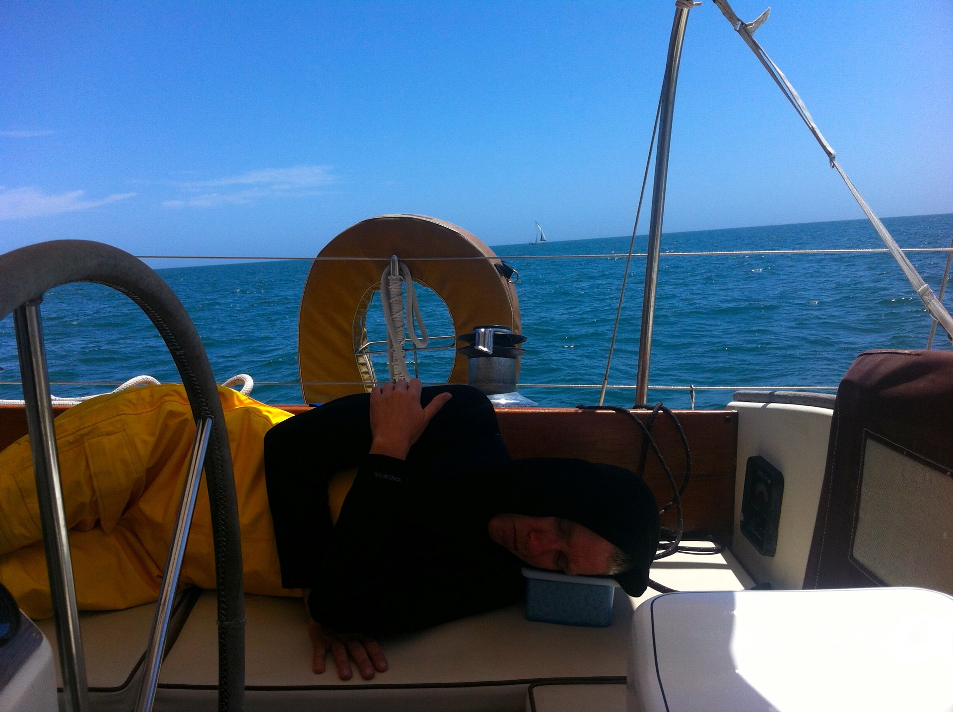
CA threw up several times.
She was uncomfortable going below to sleep, so she slept in the cockpit. The sea state wasn't bad, we've seen worse, but for some reason this trip really beat her up.
Ended at 31°54.631′N 080°46.863′W.
Travel
| Attribute | Value |
|---|---|
| Depart | Started at 31°09.571′N 081°25.329′W |
| Waypoint | Midnight 31°54.631′N 080°46.863′W |
| Time | 14h 40m |
| Distance | ? |
16th. Tuesday
Started at 31°54.631′N 080°46.863′W.
It was a dark and quiet night. The wind and seas were right on the nose.
There we are, miles to go, dead of night. Mr. Lehman is driving us forward as best he can and Mr. Benmar is steering. Nothing to do but stare at the sea, log each hour's distance made good, and stare at the sea.
CA was sea sick the entire time. She's decided that offshore passages are something that needs even better conditions than the predicted 2-4′ seas rolling in from dead ahead. We hate to be picky and idealistic, but we have the limitations we have. And if we want to be comfortable and in control of the boat, we need better conditions than wind straight on the nose.
Entering Charleston was spectacular. Last time we did it, we were so agog after only our second overnight passage that we didn't really enjoy the sights. This time, we were able to look around and enjoy the trip up the Cooper River.
At about 1700 we were docked at 32°50.600′N 079°56.583′W, Cooper River Marina, near Charleston, SC, ICW Mile 469.

Race Week
Apparently, the Sperry-Topsider Charleston Race Week starts soon.
We saw a big, serious race boat, Spookie, a Carkeek 40, practicing. It passed us like we were standing still. We saw smaller ultra-high-speed race boats. We saw the Optimist fleet. It was spectacular.
While I'd love to watch the races, we're not going to stay around, we're going to head out. But it would be cool to be part of the on-the-water spectator fleet. Maybe at the windward mark where the jibs come in and the spinnakers go up. Or maybe halfway down the course where they're most likely to gybe the spinnakers.
Check out the shape of Spookie's mains'l: it's almost flat, only a slight twist from bottom to top. And their jib echoes that main shape and is sheeted so far inboard it's practically amidships. Wowsa. That kind of sail trim spells speed. And a narrow tack angle.
While they were sailing around Charleston harbor, we were plugging along, under engine alone, not even trying to sail.
CA shot some video. I'm going to plug into into iMovie and see what I can make of it.
Gary, our neighbor from last time we were here (week 8, week 9, week 10) greeted us and stopped over for some cheese and crackers in the cockpit.
Dinner was a warmed up can of vegetarian chili. Really. We're exhausted. We took major Hollywood showers.
We covered 208 ICW miles in just 32 hours by going in a nearly straight line offshore. And we're just 64 miles past the half-way mark toward Norfolk. Downhill from here.
We actually drove Red Ranger about 145 nautical miles in 32 hours—4.5 knots—using what appears to be about 45 gallons of diesel. This is approximately the worst case in travel: pure motoring into the wind. Almost anything (wind from astern, being able to sail, a favorable current) will be better than this.
The new fuel filters have a persistent, slow drip. I hate to put too much wrench to them because I could kink the metal housing. I hate to take it apart and check the O-ring seating. But the fuel drip has to be stopped. Interestingly, there's fuel on the top, suggesting that a bleed screw isn't quite tight enough. Tomorrow I'll put a few more foot-pounds of torque on them and the clean out the engine pan (again) so I can monitor the fuel drip and the raw water pump water drip.
Travel
| Attribute | Value |
|---|---|
| Waypoint | Midnight 31°54.631′N 080°46.863′W |
| Arrive | Docked at 32°50.600′N 079°56.583′W |
| Time | 17h |
| Distance | ? |
17th. Wednesday
Docked at 32°50.600′N 079°56.583′W, Cooper River Marina, near Charleston, SC, ICW Mile 469.
Washing, Walkies and Victuals this morning. CA took a run; I handled the AM laundry load.
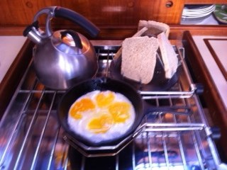
For our anniversary, CA went all out. Eggs, toast, coffee. A big, hot breakfast is so much better than a granola bar in the cockpit. But the view of the Cooper River Marina is not as nice as the Atlantic Ocean. Tradeoffs.
We think we've got the stopovers between here and Wrightsville Beach sussed out: the South Santee River, mile 420; the Waccamaw River, mile 375; Little River Inlet, mile 341. Then a long push of 56 miles to Wrightsville Beach. 184 miles in four easy days instead of a long night of sea-sickness.
Gary drove us over to the Harris Teeter and West Marine. Thanks!
CA did some more laundry in the afternoon. I cleaned out the fuel under the engine.
Dinner was Shrimp and Grits. Ah, Charleston.
Travel
| Attribute | Value |
|---|---|
| Arrive | Docked at 32°50.600′N 079°56.583′W |
18th. Thursday
Started at 32°50.600′N 079°56.583′W, Cooper River Marina, near Charleston, SC, ICW Mile 469.
We took on 63 gallons of diesel fuel.
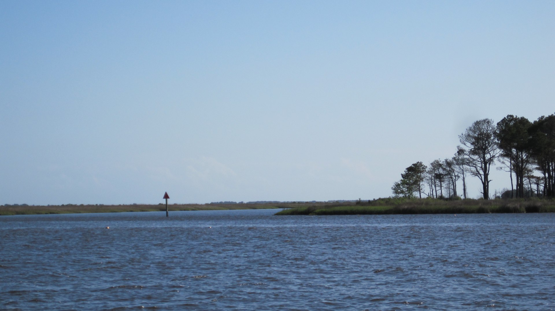
Red Ranger chugged out of Charleston Harbor. Up the various pieces of the ditch to the spot where it crosses the South Santee River. While we passed some nice-looking homes early on, a great deal of today's trip was past the Cape Romain National Wildlife Refuge. It was quiet. Scenic. Empty.
The South Santee river's got a bit of tidal current. When we anchored, the ebb current was almost perpendicular to the wind. It's not comfortable to be pushed one direction by the current and about 120° away from that by the wind. We spend almost 40 minutes monitoring the anchor and our position before declaring that we really were set.
The wind died, as predicted.
There's zero cover here. Zero. It's exposed to wind from every direction. That could be nasty in a storm. But this looks to be a calm night and we think there's great holding.
Anchored at 33°11.850′N 079°27.216′W, South Santee River, ICW Mile 420. We covered 49 statute miles in about 9 hours of motoring.
We made a pretty brisk pace compared to slogging into the winds off-shore. And no one was sea-sick. And we expect to get a good night's sleep. Except for the mosquitos that have invaded. I suspect that perhaps a dorade vent lacks proper bug screens.
Dinner was Jantzen's Temptation #1. A variation on a Swedish favorite; CA added eggplant to the potatoes, cream sauce and anchovy dish.
Travel
| Attribute | Value |
|---|---|
| Depart | Started at 32°50.600′N 079°56.583′W |
| Arrive | Anchored at 33°11.850′N 079°27.216′W |
| Time | 9h |
| Distance | 38 nm |
19th. Friday
Started at 33°11.850′N 079°27.216′W, South Santee River, ICW Mile 420.
We chugged up Winyah Bay and up the Waccamaw river for about 38 miles today.
Wind from astern the entire day. Kind of nice. The bay was whipped up to 3-foot waves. Going against the wind would have been brutal.

Heading up a river like this is fun. (Except for the wrecked boats in the trees; we've seen four.)
The lower reaches are wide open spaces, through the natural river course. It's deep and relatively free of sandbars and shallows.
As you move up, the waterway narrows, the trees get larger. The upper reaches are lined with wind-stopping mangroves, the smell of wild dogwoods and the sounds of birds. Turtles sit on logs and sun themselves.
At the top of the river, as it turns into the next canal, they dredged a straight channel that lops off a bunch of loops, leaving oxbows of deep water, surrounded by trees. The Skipper Bob Anchoring Guide lists this particular oxbow as a choice anchorage. We eyeballed one south of here that might be just as good. The chart shows another north of here that may be good, also.
There are three other boats here, providing ample proof that this is the spot to anchor for the night.
Anchored at 33°39.954′N 079°04.235′W, Waccamaw River, ICW Mile 375.
Epic rain. Epic. Weather alerts all along the east coast of the US. We're happy to be anchored in amongst the trees.
That was about 45 miles on the ICW in 7½ hours of motoring. An easy day. The next two days will be similar, I think.
Dinner was kidney beans and asparagus over a bead of barley.
Travel
| Attribute | Value |
|---|---|
| Depart | Started at 33°11.850′N 079°27.216′W |
| Arrive | Anchored at 33°39.954′N 079°04.235′W |
| Time | 7h 30m |
| Distance | 37.8nm |
20th. Saturday
Started at 33°39.954′N 079°04.235′W, Waccamaw River, ICW Mile 375.
As of 0700, it's still spitting rain from last night. We'd like to get moving, but, if we can't see very well, it's not prudent to start chugging up this river into the unknown.

We're bound for the Little River at ICW mile 341, 34 miles, 6 or so hours. This seems like a sensible anchorage.
We'd like to make it all the way to the Shallotte Inlet (ICW mile 329, 46 miles, 9 hours.) But we can't discern a good anchorage near there. We hate to wait until the end of the day only to find there's no place to drop the hook.
Today we passed through the famous Rockpile. This is a narrow stretch of the ICW bordered by rocks. Passing is nearly impossible, so the tradition is to make a "Securité" announcement before entering.
By 1300, we had gone about as far as we could go.
Anchored at 33°52.351′N 078°34.204′W, Calabash Creek, ICW Mile 341. 34 miles in just 5 hours.
Calabash Creek is not a great spot.
However.
When you compare it with the South Santee River, it has more coverage from winds. So. It's not the worst place to anchor. It's a narrow channel, but when you compare it with the oxbow on the Waccamaw River, it's got more room to swing.
So it's a good enough spot.
It's 16°C (61°F). We're freezing and happy to snuggle down and keep warm while CA bakes biscotti.
Dinner was a thick soup made with three beans plus orzo. Red beans, chick peas and fresh green beans.
Tomorrow, we hope to start early and get to Wrightsville Beach.
Travel
| Attribute | Value |
|---|---|
| Depart | Started at 33°39.954′N 079°04.235′W |
| Arrive | Anchored at 33°52.351′N 078°34.204′W |
| Time | 5h |
| Distance | 24.6 nm |
21st. Sunday
Started at 33°52.351′N 078°34.204′W, Calabash Creek, ICW Mile 341.
Idiotically, I have not been checking the weather since we decided to go inside to Beaufort. Not at all.
Big Mistake.
Today's weather, it turned out, involved gale force winds. We chugged up the ICW to the Cape Fear River in building winds. By the time we reached the river, it was blowing in the 30's and we saw gusts to 40.
At sea, that's epic bad weather. Gale Force. Big Waves. Big Water. Serious Danger.
Inland, however, it's merely bad without being epic.
And I had not checked the weather until we had gone too far to turn back.
The waves in Cape Fear were a steady march of water. Sometimes a particularly large wave would break and dowse the dodger with spume and spray. We stayed dry behind the dodger.
But, the waves were closely spaced, and most were under 4' tall. So Red Ranger was able to glide through them reasonably smoothly. The wind would turn her off course in a heartbeat. A moment's inattention and she was pointed sideways. But the motion was comfortable.
The noise level, however, was hellacious. A gust to 40 knots rattles everything. It screams through the rigging. The sail covers and bimini don't flap like flags, they snap and boom alarmingly.
You can't easily duck out from under the dodger to look into the wind to check your bearings. If you lost sight of the mark because of a wave crashing over the bow, you have to check the chart plotter and hope you didn't drift too far out of the channel while you wait for the water to be blown off the windows.
Adding to the misery: the ebbing tide was against us almost the entire day. We had to wind Mr. Lehman up to something like 1900 RPM to power through the current in Snow's Cut fast enough to make Wrightsville Beach before dark. We used diesel like there was no tomorrow.
For the win: it was about 13°C (56°F). This wind is from the frozen north, where they're getting some kind of winter storm.
Anchored at 34°12.248′N 077°48.095′W, Wrightsville Beach, ICW Mile 283.
Distance was 58 miles in 11 hours. Not a bad pace, really.
Dinner was a can of beans and coleslaw. The propane system has failed, there is no propane. No hot coffee. No not meals. I think the pressure gauge has failed and this drained the big tank. (The little tank lasted us from through the Bahamas and back to St. Augustine; it was empty.)
We've been checking our position frequently. Our Anchor Alarm app on the iPhone shows that we've only moved 20 feet, mostly in a well-defined little oval. The Rocna is holding. We're so happy to be able to sleep soundly.
Tomorrow, we'll see about repairing the propane system. I'm not sure I want to try and take it apart if the winds are still blowing into the 20's and 30's. Maybe I'll just call around to find the nearest place with propane system parts. Our tanks need to be recertified (or replaced) in 2013. We need a full-service dealer. Ideally, close enough that we don't have to spend a fortune on cab fare.
Travel
| Attribute | Value |
|---|---|
| Depart | Started at 33°52.351′N 078°34.204′W |
| Arrive | Anchored at 34°12.248′N 077°48.095′W |
| Time | 11h |
| Distance | 52.3nm |
This Week
Engine Hours: 64. Diesel Gallons: 63. Water Gallons: 25. Miles Run: 342.
Books: Stalking the Blue-Eyed Scallop. Salt. Anthropology of an American Girl. We're also catching up on magazines this week. We got a stack of paper in St. Augustine, as well as downloads. Rolling Stone. Scientific American. Saveur.
Read Aloud: A Dance with Dragons: A Song of Ice and Fire is done. Sniff. George R. R. Martin is a cruel writer. Cruel. We're looking at The Name of the Wind: The Kingkiller Chronicles as another big saga.
Travel
| Attribute | Value |
|---|---|
| Engine | 64. h |
| Fuel | 63. gal |
| Water | 25. gal |
| Distance | 342. nm |
