

Started: Vero Beach Marina, 27°39.69′N 080°22.35′W
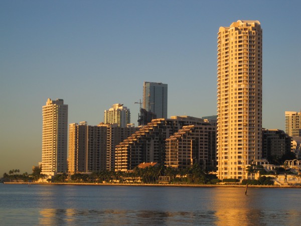
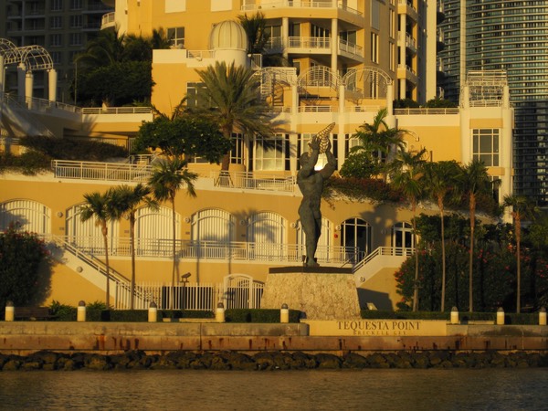
Ended: Coconut Grove near Dinner Key Marina, 25°42.92′N 080°13.63′W
Log: 155 nm. Time: 24 hr. Engine: 24 hr. Fuel: 29.1 gal.
Dropped the anchor at the edge of Biscayne Bay. Not a lot of protection here, and it's shallow. But we're here. Problems? A few. We handled the problems. We didn't break out Plan B; but we thought about it. We even handled the weird stuff.
Some folks ask for details on how this whole sailing offshore works. Some folks don't. I'll elaborate on the trip and the problems we faced and their solutions. I'll explain the Designated Worrier.
Often we're asked how we keep from spilling the olives out of our martinis in a sailboat that heels over so far. We have a solution for that, too.
Pre-Planning
There is no such thing as pre-planning. It's just planning.
Since we don't know where we're going, we start with a bunch of local information.
There are three prominent kinds of local information, you'll need them all.
-
Print. Heavily edited. Very reliable. Slow to change. To be competitive the cruising guides have to be good. Some are sponsored by advertisers and have a lot of slick color pictures. Others are less slick, with less advertising, but no less valuable. Mark and Diana Doyle. Dozier's. That kind of thing.
-
Online. Less heavily edited. Often reliable. Frequently updated. Salty Southeast Cruiser's Net. Active Captain.
-
Word-of-mouth. We get this from other cruisers. This is a lot like an on-line cruising guide, but it involves more beer. It's called "chart talk". You bring a chart and some beer and they color in the important details. Some folks are very trustworthy; some have damaged recollections; some are reckless knuckleheads; some have a different kind of boat. It takes some sifting.
Which brings us to critical resources and their role in planning.
Resources
Charts. In addition to guidebooks, charts are essential.
They're a legal obligation for obvious reasons.
The prudent mariner never relies on a single source for navigation information. For us, this means multiple charts: paper as well as electronic. And multiple electronic charts. Our iPhones, iPad, MacBook Pro and the Standard Horizon chart plotter in the cockpit all have charts in addition to the big MapTech Florida East Coast paper chart kit.
Weather. We have several weather apps on our iPhones. Plus we talk to other sailors. We use Intellicast Boating, Windfinder, AccuWeather Marine Weather, plus the http://weathercharts.org links to the NOAA surface analysis and the 500 mb analysis.
It's not like we understand more than about 50% of the weather information. We're struggling to understand the difference between cold front and occluded front.
But.

We do get wind and wave height. And we understand the effect of wind going one way and the current going the other. We're aware that frontal boundaries move counter-clockwise around the big L's on the surface analysis chart. And we know that a big H involves happy weather.
A Detailed Plan
For Red Ranger, The Commodore insists on three parts to the detailed plan:
-
Objective. She sets the objectives. The rest of the crew (me) implement it. Sailors are careful about keeping the goals low-key. We're taught to say that we're "Bound for Miami". We're not going there. We may never get there. We may go somewhere else first. But we're bound for Miami.
-
Some sequence of events with estimated times. Plan A. She requests and requires that I write this down and circulate it. They call it a "Float Plan". (Who are they? Not sure. US Power Squadron? US Coast Guard Auxiliary?) We email it to a selected few contact people, including our Designated Worrier.
-
Contingency plans. Plan B, C and on, and on. We don't publish these. But we have them.
In this case, the objective was Dinner Key, also known as Coconut Grove in Biscayne Bay, just S of Miami, FL.
We send our overnight "float plan" to selected contact individuals. The same folks are also the recipients of our Spot locator messages. One person, The Most Venerable Great Aunt Diane, is our designated worrier. We generally send a midnight position and a final position to show our progress for overnight passages. If she doesn't get the Spot messages, she's in charge of altering the USCG of an overdue vessel.
We also send separate text, email and often phone calls, just to be sure she's been informed.
Sample Float Plan

Our Float Plans have two parts. The top bit is a detailed vessel description. We think this will answer most questions the USCG will ask about the vessel, and its safety features.
The second part is a sequence of waypoints: departure, zero or more intermediate positions, and a final position. This is our detailed sequence of events for meeting our passage objectives.
The idea is to provides some sense of where we might be along the way in case something went amiss.
On this trip, something did go amiss, but we fixed it, and it didn't cause a significant delay. Indeed, we were mostly ahead of schedule the entire time.
Plan B Review
The Commodore insists on a formal review of Plan B and C and any other bright ideas I may have.
In some cases, she catches me without much of an answer. That forces me to go open up my passage notes files on the computer and report something half-assed and dumb-sounding. I'm getting better about having the necessary Plan B information entered into the chart plotter on deck.
This time, however, I had a really good answer. Mostly because we did this trip last year, and I had updated the chart plotter information for this trip.
The MapTech books provide a series of navigational waypoints that are strongly-worded suggestions. They're not "official:" they don't necessarily correspond to specific buoys or other aids to navigation (ATONS). But they're places you really should program into your chart plotter. You'll want them handy.
For example, MapTech has a waypoint FE116 which is more-or-less the location of the light for the entrance to Miami harbor. We don't have all of the MapTech positions in the chart plotter, just the ones for the easy-to-navigate inlets: St. Lucie (Stuart), Lake Worth (West Palm), Hillsboro, Ft. Lauderdale. Each of these is its own bail-out spot.
Plan B Execution
Back in December, leaving Charleston, we did a Plan B Bailout. We tucked into a creek and waited for the sea state the settle down, then resumed our trip a day later and much happier.
Because The Commodore insists on having a Plan B, there's no big problem in executing the Plan B. We just do something instead of Plan A. They're all good plans — switching plans is not a failure, it's just an alternate form of success.
On this trip, we had an odd engine noise.
We don't hear it often. And the first few times we heard it, we had no clue what it was. Now, I'm pretty sure it's simply a fuel filter. It's hard to be sure. But switching the Racor filter from the port side filter (the one we normally use) to starboard side eventually rectified the problem.
Emphasis on the eventually.
In previous encounters with this specific noise, I would switch filters expecting an instant response. Since I didn't get an instant response, I was unsure what was going on in the engine. This time I gave Mr. Lehman 10 minutes to respond. And he did. Problem solved. Lesson learned, too.
Standing Watches
With just two of us on Red Ranger, we do four hours on watch and four hours off watch. CA wants dawn, which is 04:00 to 08:00. So I get 08:00 to 12:00, 16:00 to 20:00 and 00:00 to 04:00. She gets her dawn watch, plus 12:00 to 16:00 and 20:00 to 00:00.
For offshore, we generally try to sail during the day and motor-sail at night. Since we're only doing coastal cruising, we can afford to burn fuel like that. We burn less than 24 gallons in 24 hours of motor-sailing, so we can go three full days without much trouble.
If we were trying to cross oceans, we would reduce sail at night, but not motor extravagantly.
We don't like the idea of scrambling around on deck to reduce the mainsail at night if the wind picks up. We like the idea of pre-reefing at night. Or sometimes swapping out the main entirely.
This last run, for example, we had a pleasant NNE wind in the morning. We put up the full mains'l and the big yankee. The wind — by itself — wouldn't get us to Miami in 24 hours. So we motor sailed to keep our speed up.
At 17:00 (prior to sunset) we struck the mains'l and put up the mizzens'l. We sailed like this until something like 23:00 when the wind backed around into the SSE. At that point, we were no longer broad reaching, but beating, so CA put down the yankee and put up the stays'l.

That worked until about 02:00 when the wind backed further S and became so light as to be useless. So I rolled up the stays'l and we motored on under mizzens'l and Mr. Lehman.
Timing the Entrance
We can't actually sail at maximum speed. Weirdly, we have to slow down so that we can arrive about dawn. We can't arrive early because we don't know the entrance and don't want to risk attempting the entrance in the dark.
In this case, the trip is about 123 nm in the offshore legs; 155 nm overall. 155÷24=6.45 kt as an overall average speed. We typically try to motor at about 6 kt, so — if anything — we'd need to push for more speed, right?
Not so much. The first 12 hours — with a few exceptions — showed speeds as high as 6.9 kt. Motor-sailing with a fair following breeze is a wonder. We knew we'd get into trouble around sunset as we we passed the Jupiter Inlet. The Gulf Stream is only a few miles offshore from there down to Ft. Lauderdale. The current would be set against us, slowing us down. Old salts told us to stay inside the 10-fathom line to avoid the Gulf Stream.
We saw some effect, from the stream, but it was minor. We kept up our speed and until we figured out that we were a full 3½ hours ahead of schedule.
Clearly, the stream wasn't slowing us down much at all. Sometime during her 20:00 to 24:00 watch, CA cut our speed and cut our speed again until she had us timed to arrive in Miami at marine twilight (48 min. prior to dawn, about 06:07.)
And she had to do the calculation is based on a route that included the south tip of Key Biscayne. Our chart plotter's ETA was computed for a point 19 nm beyond the Miami government cut entrance.
Of course, entering Miami means that there will be container ships and cruise ships occupying the channel. Carnival Victory (I think) chugged past us as we poked our way up the channel in the growing daylight.
The good news is that our radio/chartplotter combination reports the AIS information which includes a computation of how close and how soon. If it's real close and real soon, we need to take evasive action. Otherwise, we can move at our usual stately pace.
The Martini Issue
There are actually three solutions to the problem of keeping the olives in the martini glass when sailing on a boat with a big heel angle.
-
We never drink underway. Coffee, tea or water is it.
-
We try not to heel. There's an optimal angle of heel; beyond that, the sail is spilling wind because the boat is tipped over too far. Many hulls are designed to lean at no more than 15°. I think that's probably true for Red Ranger, even though we're sometimes uncomfortable at that angle. We'll often reduce sail to keep her flatter.
-
Sippy cups.

Looking forward to exploring Miami.
If you're in the area, call or write. We'll go sailing.
Travel
| Attribute | Value |
|---|---|
| Depart | Started: Vero Beach Marina, 27°39.69′N 080°22.35′W |
| Arrive | Ended: Coconut Grove near Dinner Key Marina, 25°42.92′N 080°13.63′W |
| Log | 155 nm. |
| Time | 24 hr. |
| Engine | 24 hr. |